
Another bridge problem on the Jubilee Trail
Dorset Council has removed an unsafe footbridge on the Jubilee Trail in Broadmayne (grid reference SY 74173 87173). The bridge in question is mentioned on p.17 of the latest edition of the Jubilee Trail guidebook in the sentence which reads "the path now follows a stream to a stile and bridge at Watergates Cottage." It is possible to avoid the missing bridge by using footpaths S51/14, S9/5 and S9/4 (consult Dorset Explorer for the path numbers and look in Countryside layer for Rights of Way Labels). We do not presently have a timetable for the replacement of the bridge.
New information board on Wessex Ridgeway

North Dorset MP, Simon Hoare, joined Dorset Ramblers and Dorset Council officers to unveil a new information board on the Wessex Ridgeway at Okeford Hill in July 2025. The Wessex Ridgeway is part of the Great Chalk Way, a coast-to-coast path running along the chalk ridge which crosses southern England between Lyme Regis and Norfolk. A family of paths, the Great Chalk Way links the Wessex Ridgeway with the Ridgeway National Trail, the Icknield Way, and the Peddars Way National Trail.
Janet Davis, chair of Dorset Ramblers said
“We were very pleased to be able to fund this new information board and that Simon was able to join us to unveil it. We are also most grateful to the Dorset Council ranger team for its installation. The board details the fantastic historic resource running beneath our feet and we hope that many people will take the opportunity to explore the route, both here in Dorset and beyond. Walking is a healthy and free activity and routes like this help us to understand our links with the landscape and the natural environment.”
The Wessex Ridgeway was the brainchild of Priscilla Houston, one of the founding figures of Dorset Ramblers. She established the route through Dorset and wrote the first guidebook in the 1980s. The latest version of the guidebook, produced by Dorset Council is available on their website here.
Janet added, “The idea of the much longer Great Chalk Way would, I think, have pleased her enormously and the Ramblers welcomes the opportunity to continue our link to this important trail.”
Dorset Area - 50th AGM

Our 50th AGM was held on Saturday the 30th November 2024 at Broadmayne Village Hall. We kicked-off our golden anniversary celebrations with the cutting of a specially commissioned cake at the AGM, and during the year we will be working on a 50 favourite walks project.
Dorset Area was formerly part of the South East region of the Ramblers' Association (the Ramblers). It then became part of Wessex Area, and when local government reorganisation in 1974 put parts of Hampshire into Dorset, the Dorset Area was created. Membership was then just under 400 and there was one Group, East Dorset. In 1981, the South Dorset Group was formed, followed by North Dorset in 1989 and West Dorset in 1994. At the end of September 2024 membership stood at 1,36
Jubilee Trail Guide 4th Edition Now Available
The 4th edition of the Jubilee Trail guide has been published see our Dorset Jubilee Trail page
Countryside Code Update
The countryside code pagehas been updated to include Covid 19 short versions of the code.
Please take note of the text about not having fires and BBQs.
The Ramblers Don't Lose Your Way Campaign
Following the UK Government’s announcement that it will scrap the 2031 deadline for saving lost paths in England, the Don't Lose Your Way (DLYW) Team is evaluating the project, and further information will be posted when available. In the meantime if you have any questions, please contact the Footpath Secretary using our Contact page.
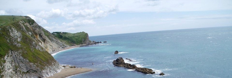
The King Charles III England Coast Path
Natural England “the government’s advisor on the natural environment” planned to open the King Charles III England Coast Path around England’s coastline by 2020. Full details of progress can be obtained here.
Status in Dorset
Rufus Castle (Portland) to Lulworth Cove was opened on 29 June 2012 and was the very first section opened on the English Coastline
Lyme Regis to Rufus Castle (Portland) – implementation of this section was held up owing to a public inquiry which was held in November and December 2016.
Lulworth Cove to Kimmeridge Bay - on 23 July 2025, Natural England submitted a report to the Secretary of State for Environment, Food and Rural Affairs setting out the proposals for improved access to the coast between Lulworth Cove and Kimmeridge Bay. Dorset Area will be preparing comments on this report over the next month. You can read about Natural England's proposals here.
Kimmeridge Bay to South Haven Point - on 6th April 2022 the Secretary of State for the Department of Environment, Food and Rural Affairs approved Natural England’s proposals to improve access to the coast between Kimmeridge Bay and South Haven Point. Following this approval, Dorset Council has completed the necessary works to make the route accessible to the public. The new public access rights relate to the KCIIIECP and an associated coastal margin over which the public have a right of access, subject to local restrictions and exclusions.
For more information please contact the Area Footpath Secretary (see Contact page)
Adjacent Counties
Kingswear to Lyme Regis - the 68 miles (110 km) stretch from Kingswear in Devon to Lyme Regis is now open to the public. Coastal access rights came into force along this stretch of coast on 31 July 2024 by order of the Secretary of State.
Highcliffe to Calshot (approx 56 miles of coastline) – proposals have been published but not yet determined.